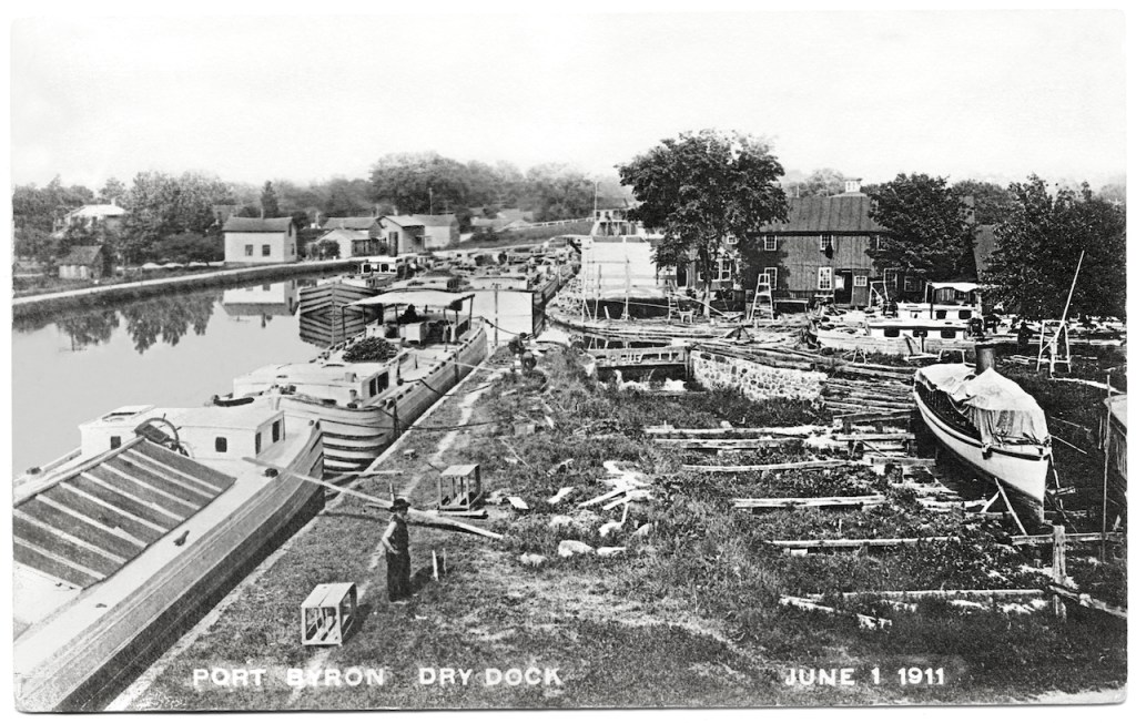
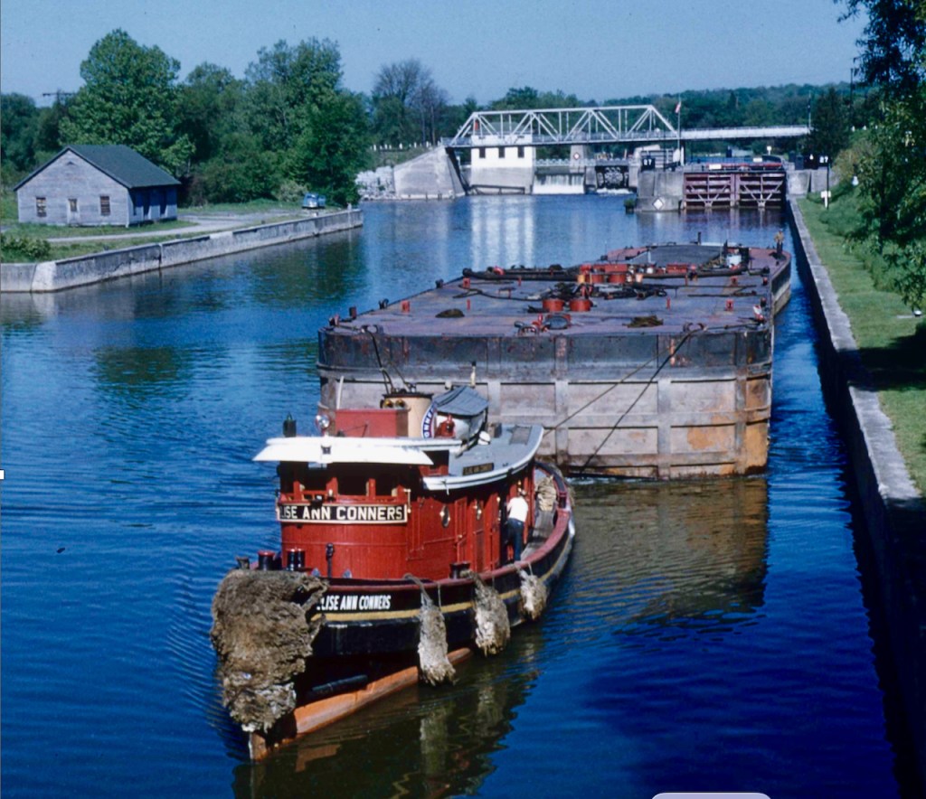
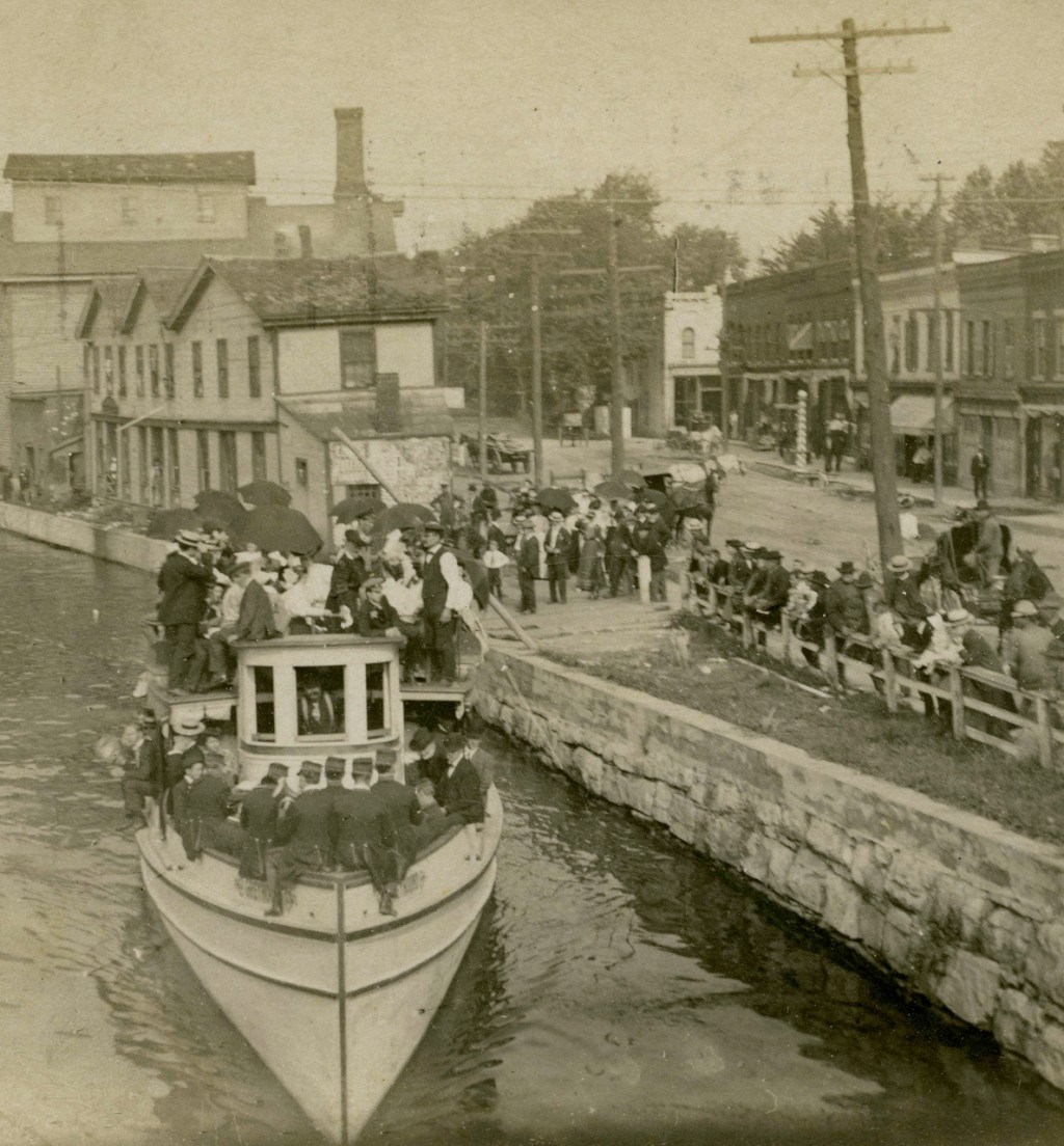
I’m so happy that someone at some point had the foresight to put location and date on this photo. Without that information, this would still be an interesting scene, a tableau of boats and workers on an artificial river.
On the far side of the canal, I see two men. On the jam of boats, I see at least three, appearing to be minding their separate barges, not interacting with each other. On this side of the canal I see the hatted man prominent in the foreground, two more near the junction lock gate that controls access to the dry dock, and then three more at least to the right. Besides barges, there’s a steamer, partly covered. I wonder if that stone wall in the center of the photo was demolished and removed, or might it still be there, buried.
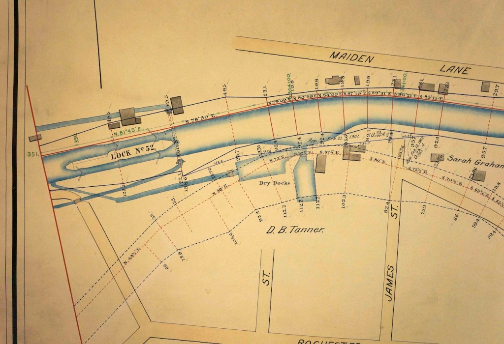
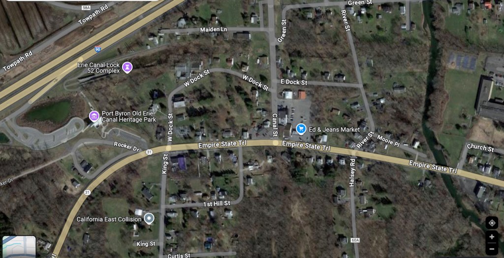
I’m not sure of the date on the map below, but to the left center, you can see lock no. 52, and then moving toward the right along the canal, you see two dry dock areas identified.
This 1904 map shows the same area to the left, although lock No. 52 is labeled as lock No. 2, for which I have no explanation. Maiden Lane [above] has become Maiden Avenue, and the Erie ran between it and Dock Street. Also, if you follow Rochester Street from the left to Owasco Creek and cross the creek, you see the Catholic Church labeled. The Catholic Church has now been named the Samuel Center for Canal History, namesake of this blog.
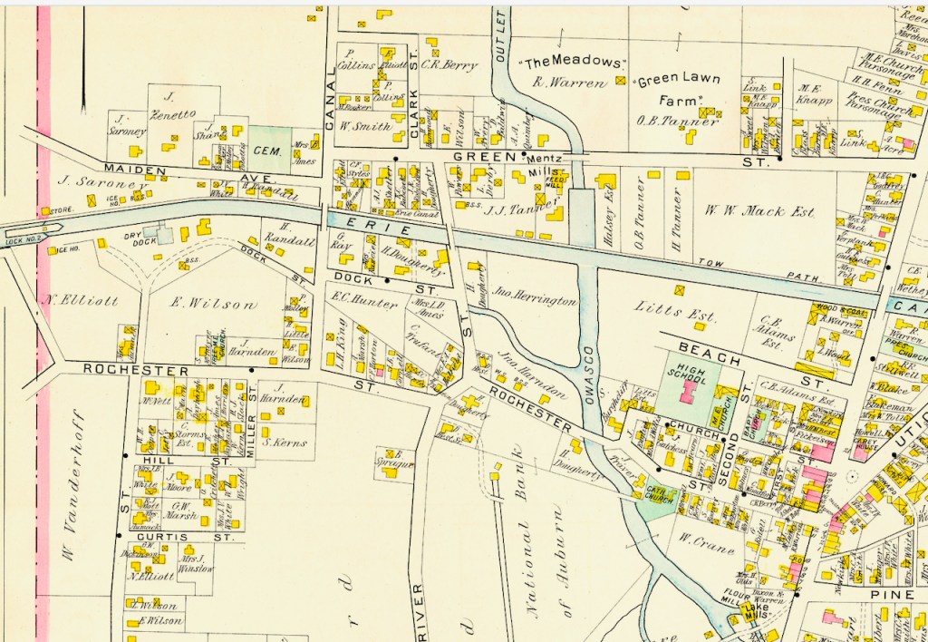
Click on the interactive map of the same area below, and you can locate Erie Canal Lock 52, Maiden Lane, W Dock Street, and the Samuel Center all in their contemporary context.
I’d love to do more “then and now” posts, contextualizing some of the thousands of photos from over a century ago currently in the collection. I have a candidate ready for the next post, but I’ll need the assistance of some folks who know the Canal in Palmyra a lot better than I do. I’m going to reach out.
Meanwhile, thanks to William Hecht and Craig Williams for help with this post.

Leave a comment