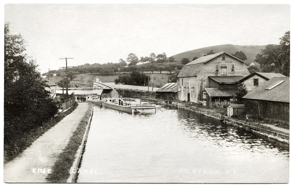
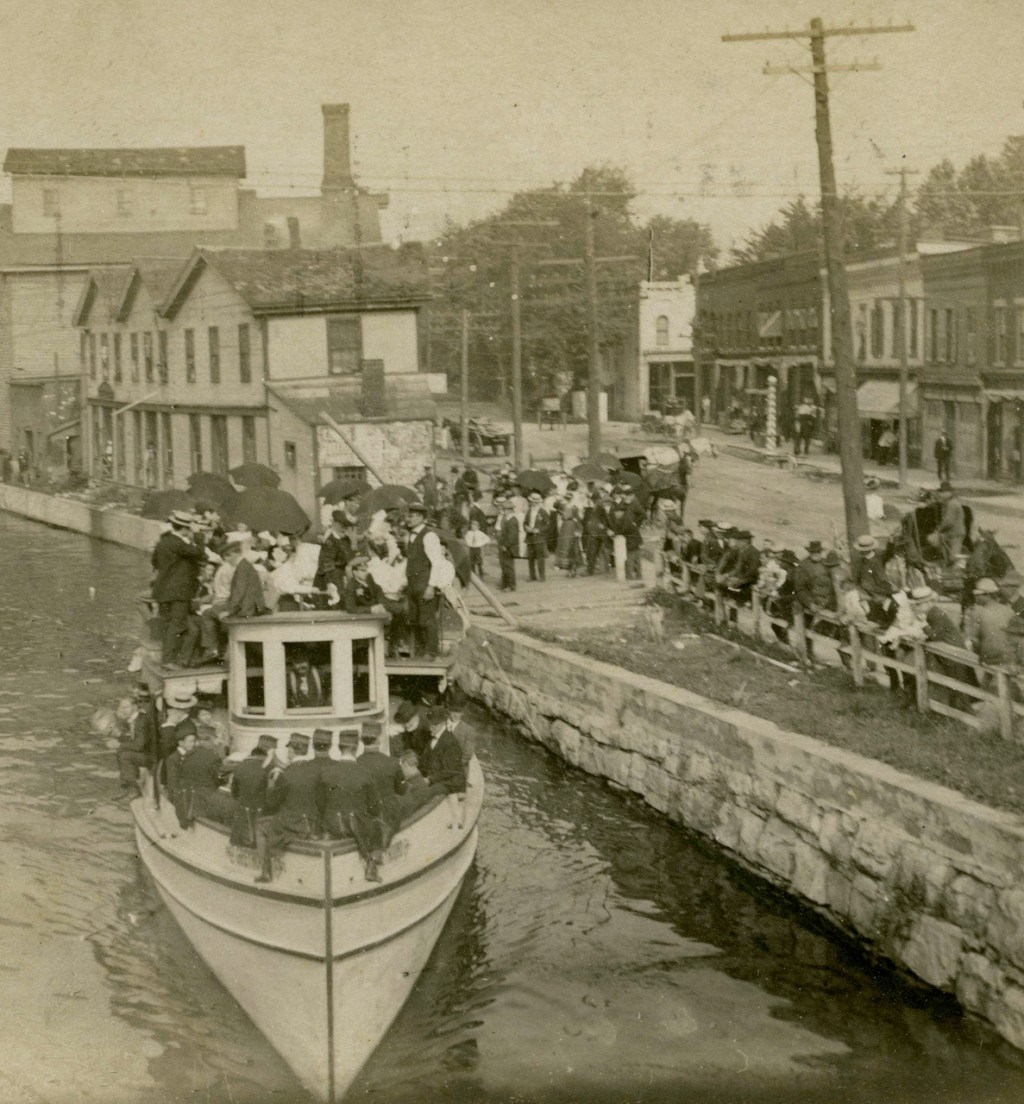
This intriguing image makes me wish I lived closer than 300+ miles.  I see clues I’d like to check, like the ridge off to the right, assuming I’m looking east.  Given the caption and a clue “taken from the Main Street bridge looking east toward the Utica St bridge (NY Route 31)” I assume that ridge is still there.

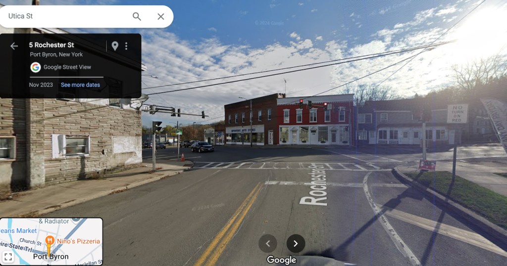
Is this what this location looks like today?

The ghost writing on the west side of the barn is mostly illegible to me.  Would this be the same Sterling Salt Co.?

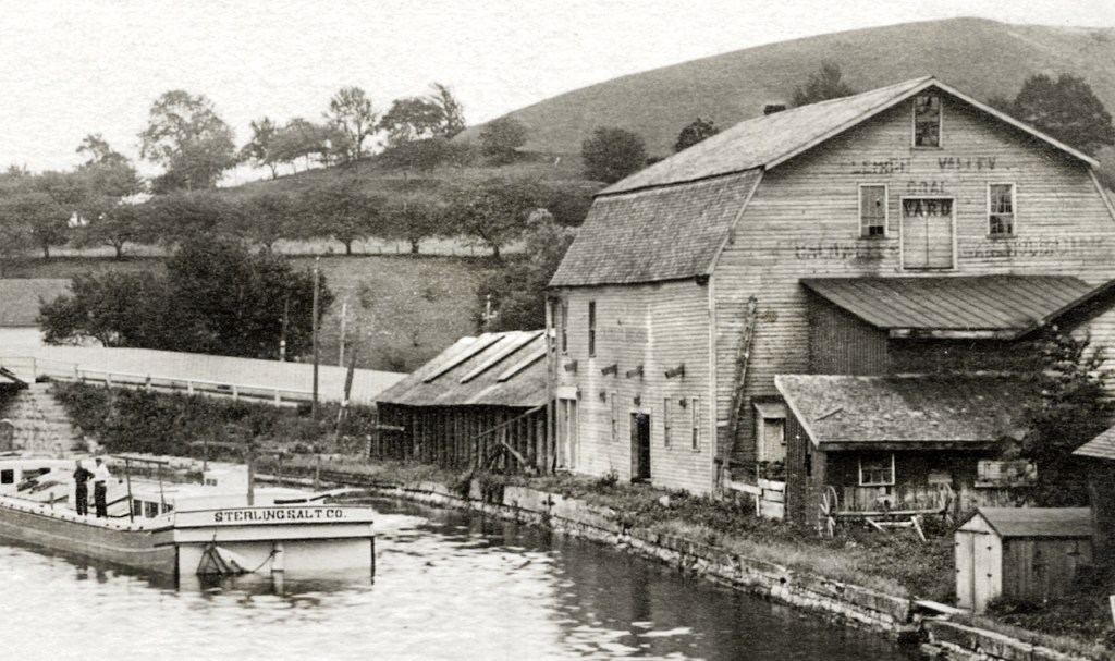
Would the bridge abutment stone have been moved and repurposed?

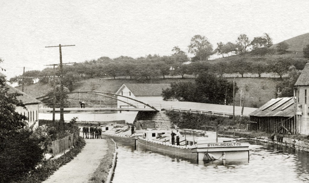
Given that the barges are moving eastward, I’m not sure I understand why the team of draft animals are standing where they are.

Intriguing image, yes. But the aroused curiosity is not satified.  Can anyone help?

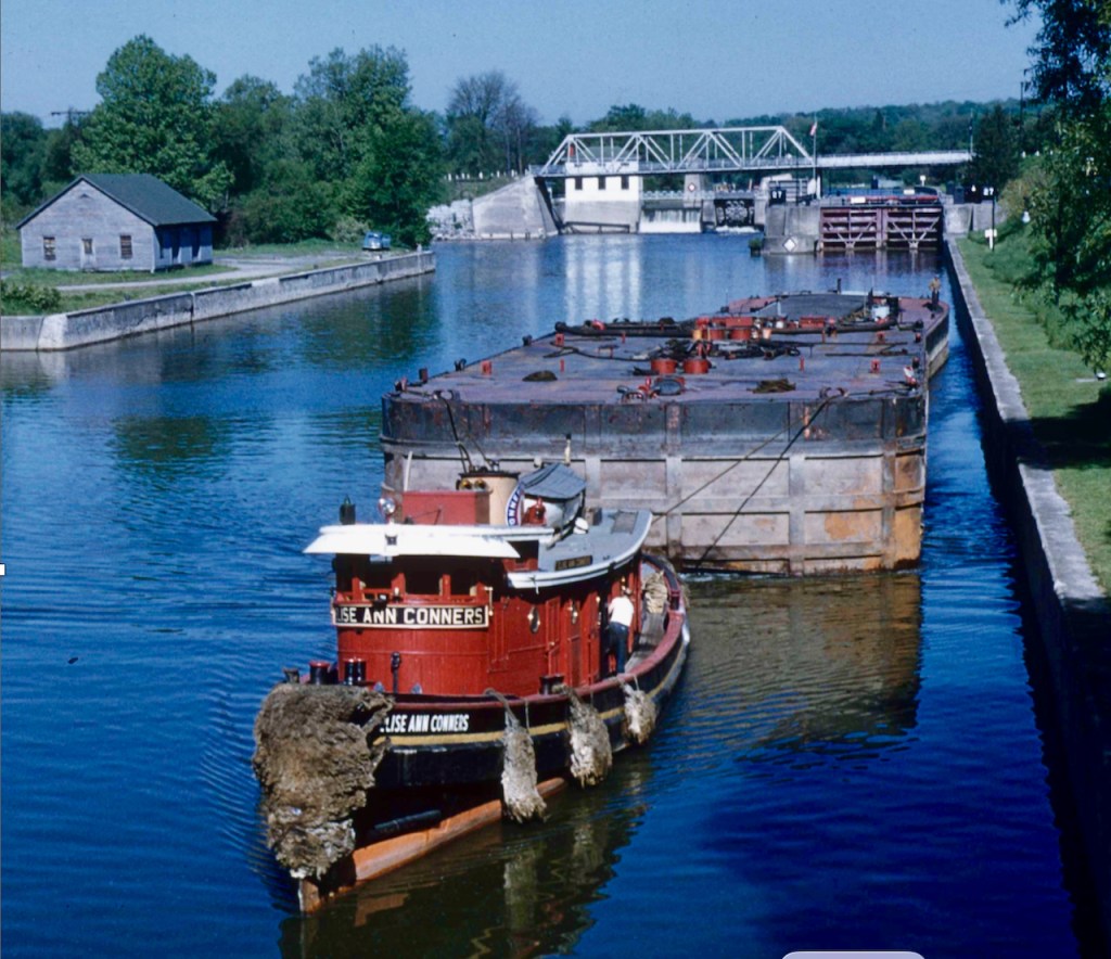
Here was Port Byron Then & Now part 1.


7 responses to “Port Byron Then & Now 2”

  1. Looks like it says Leigh Valley Coal Yard (the Leigh is unclear, the coal is right above the door, the yard

  2. Lehigh Valley Coal Yard (Pennsylvania coal). There’s additional writing but it’s even less legible.

  3. It says Lehigh Valley Coal Yard (a Pennsylvania coal). The rest is not clear, but I’d guess the name Caldwell on the left side.

    The area can be looked at on various maps, for example https://ccgis.cayugacounty.us/webapp/tmo/ starting with Tax Map Number: 81.16-2-18 (Schasel Park). You’ll be able to pinpoint where the canal crossed Main Street and Utica Street. You can also visit USGS.gov where you can locate topographic maps of Port Byron NY from about 1909. Compare these maps with Google or Bing satellite views to see there’s little or no hint of the bridges that existed on Main Street or Utica Street.

  4. The barn is there today, and the Federated Church is visible in another picture.

    1. Dennis- Thanks for that. Next time I’m in Port Byron, i’ll take some pics of the area. W

  5. Those USGS maps are great! You can fade back and forth between the current map and an old one to directly compare features… in this case I selected the Weedsport NY 1902 version.

    The vantage point in the photo would be impossible to duplicate today because of tree growth between Main St and Utica St (Rt 31), but the metal arch bridge in the middle distance was located on the present Rt 31 between house numbers 37 and 33 (on Google maps). It looks like the big white barn next to the old canal has gotten a new roof, been painted red and converted into a residence (#37). I don’t think the house that’s partly visible on the opposite side of the canal from the barn is the same structure that’s there today (#33).

    The current location of the parking lot for the Empire State Trail/Erie Canalway is just out of sight around the bend at the left of the photo. The big hill in the right distance is now completely forested. Much has changed in the past 12 decades.

    1. Thanks for pointing me in the direction of those USGS maps.

Leave a reply to crmciver Cancel reply

Trending