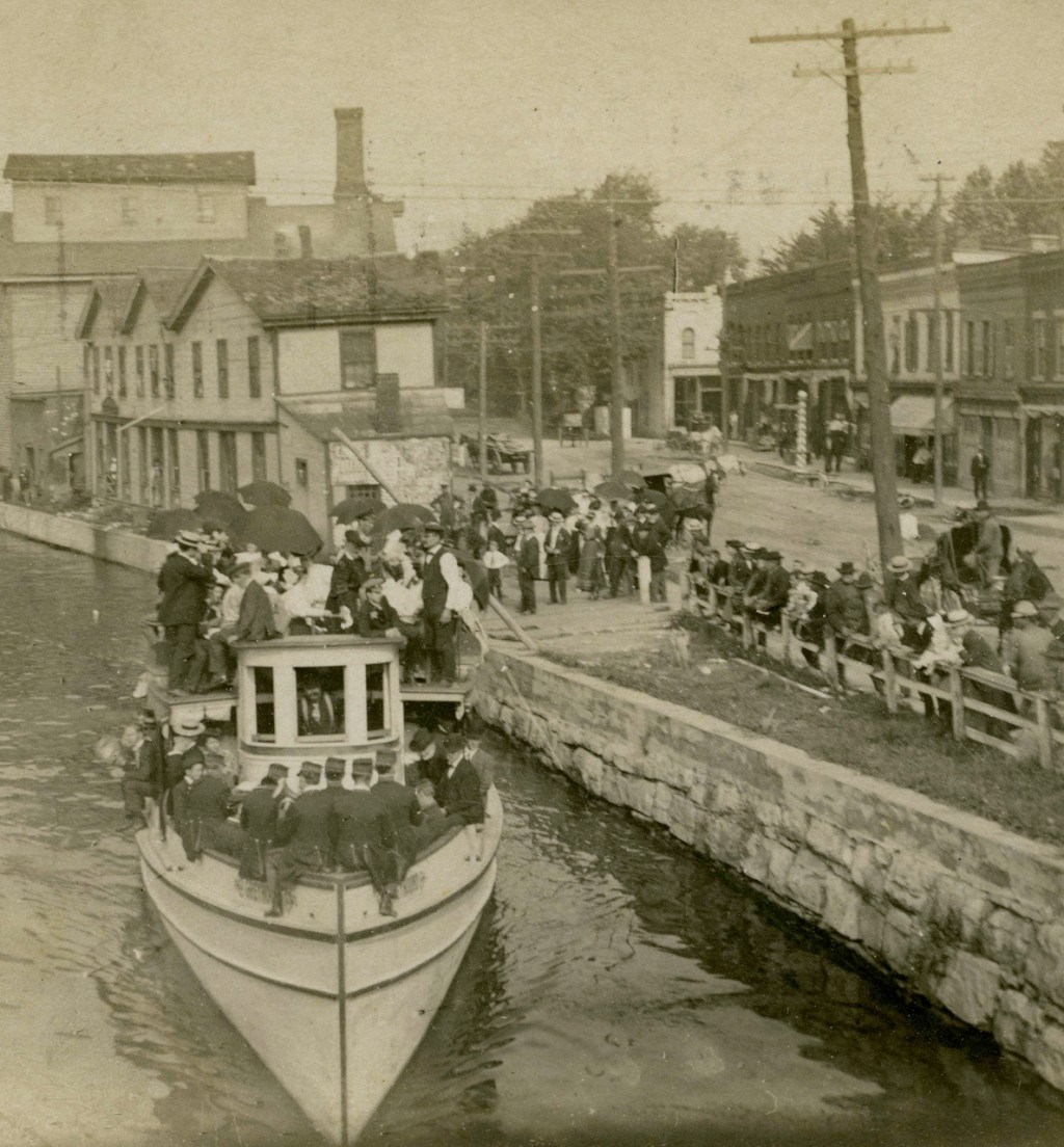
Let me just pick a date out of the hat . . . say June 3, 1895.  That’s an arbitrary date, a colorized image, a not uncommon incident at some point in history in Newark NY:  an animal-drawn maybe double-header barge approaches, and several men on a bridge are at leisure to watch. 

I grew up near Newark, so I’m calling out to all my Newark readers to help me locate what this piece of real estate looks like today.  Those stone abutments might still be there.  And the sign on the building just beyond the right side abutment reads “Newark State Bank.”  If we locate this location, we could possibly come up with a photo of the same scene on –say–June 3, 2025.  Can you help?   I suspect we are looking east, given the location of the towpath.

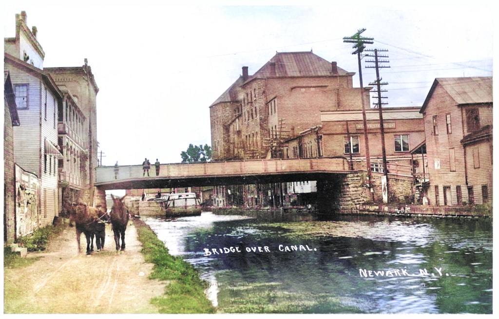
Bill Hecht gets credit for cleaning up this image and then colorizing it.  The image is from the Canal Society of New York collection. 

Here we zoom in on the left side of the image, a man walks the towpath behind two mules.  I wonder what led the four (or are there three?) men on the bridge to linger there.  Were they watching the photographer as well as the tow?  Was some suspicion a motivator or just curiosity?

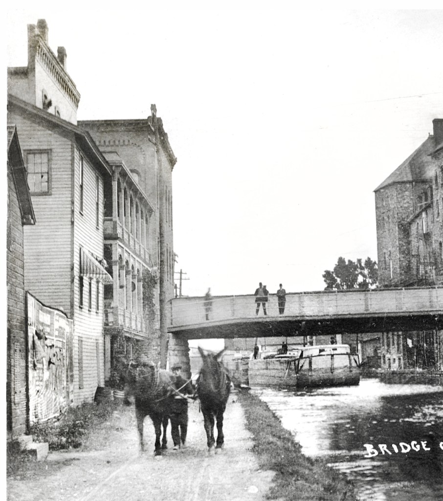
I see at least four people on the forward barge.  Two women maybe forward and two men toward the stern?

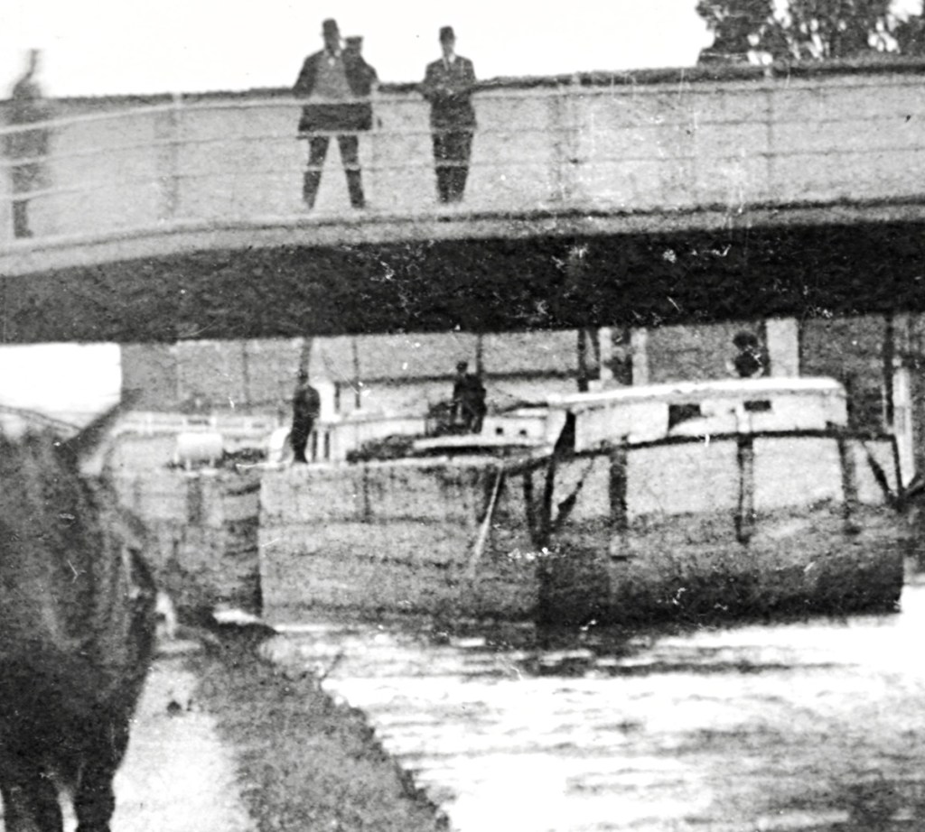
Unlike NYS canals of the past 100 years, the 19th century canals certainly were main streets.  It seems one could hardly walk along the far side of the canal under the bridge.  

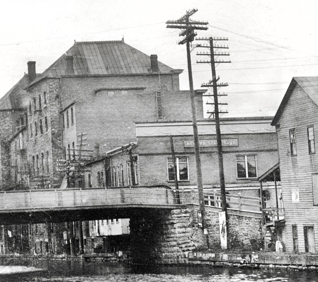
What years did Newark State Bank operate and have this prime location?  What’s there now?

I do hope some of my Newark friends give these images a look and comment below.


5 responses to “Incident in Newark NY”

  1. Will, I did some research of old Newark online. Maybe you know all this, but a Joseph Miller (1769-1831) from Vermont founded Miller’s Basin, renamed Newark, prominent on the Erie Canal route for many reasons, including being a grain export town and home of the famous Jackson-Perkins roses, which beautiful gardens I remember as a child. Gov. Clinton stopping there, meeting Joseph Miller in 1825, with a Miller Road obviously named for him. There is a state marker for his old house which is now gone (see web site below). Your postcard photo was likely east of the main road (Rt.88 which runs north/south), perhaps east of the grain mill (where my dad had worked in early ’60s). The above postcard buildings are closer to the canal than the old grain mill was, though it is all on low ground in that area of Newark, below what is “downtown” which is on a higher elevation. Beyond the mill, going west, the land rises, or so my memory says. There is a reference to an old bridge that deteriorated badly in one article I read online; perhaps that was the bridge in your postcard. Creeks were even rerouted when the Erie Canal was built. Find more info here:  LOOKING BACK — Newark’s founding father had Erie Canal contract | Lifestyle | fltimes.com This article refers to: “the map also shows two canal basins on the south side and on either side of the Vienna Street bridge. A basin was used to accommodate loading and unloading of both freight and passengers well out of the way of the steady flow of traffic.”

    I used to have a photo of Jim Miller’s old feed mill where my dad trucked from to deliver grain to local farmers, your dad included, but deleted it several years ago. I assume Jim was a descendant of the city’s founder, Joseph. Jim had quite an “estate” outside Newark, but I no longer recall how to get there. He had a lot of fruit trees on left side of a long lane that led to his large house and barns up on a rise. He had a large outdoor playhouse for his daughter. However, I could find nothing on a James/Jim Miller, not even an obit. Nor can I find anything about the old feed mill, now unoccupied and boarded up. I seem to recall seeing old grist stones inside. I remember there being RR tracks immediately next to that mill, so the canal was south of the tracks. There was an office/sitting area when we first walked in, the guys having coffee and talking when we used to go on Sat’s. I remember grain shutes that filled burlap bags in a large open “room”, impressed with the old open beam construction at that young age. I would love to find old photos of that mill when it was operational.

  2. I concur that it is probably not far east of the RT 88 bridge. I think some of those old buildings could still be standing along what is now RT 31 in the area of current lock 28B.
    So much of the area behind the buildings has been filled in during the building of the barge canal ( today’s Erie).
    If I go that way tomorrow I will get some pictures and try to compare them.

    I’m also wondering if this area might be behind what is now Cannery Row Mall. That used to be an old canning factory, and there might be some traces there.
    Unfortunately, so much has been demolished, rebuilt, and demolished again that verifying this specific area will be difficult or impossible. But I will try. I love a challenge, especially about the canal.

    1. Thanks, Jim. I remember that “cannery.” My father used to get pea vines from there to feed the dairy cows. You’re right . . . so much has changed. In fact, if I saw a photo of the pea vine piles we used to pick up, I’d not even remember it as Newark NY.

  3. From the Newark-Arcadia Historical Society, “Looking east toward Lyons. None of the buildings or abutments are there anymore. Urban Renewal took most of everything in the 1970s.”

Leave a reply to Linda Roorda Cancel reply

Trending