Here was the first post in this series, featuring maps from the 1930s, maps on paper, as they all were then.
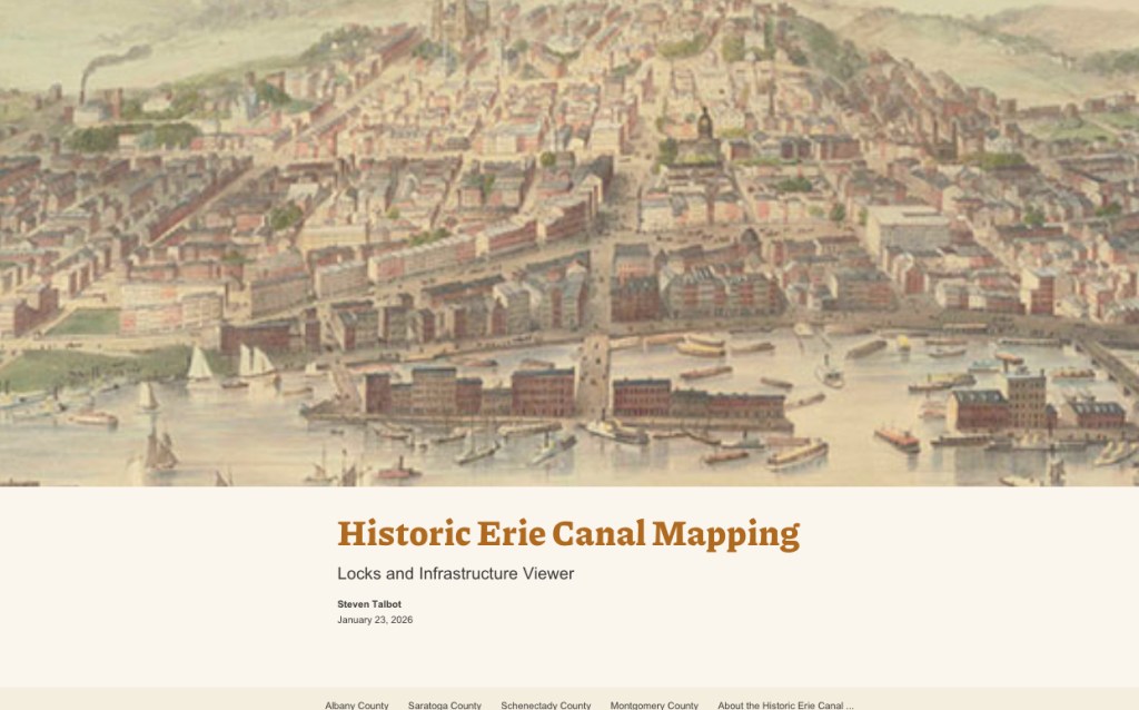
Steven Talbot, a long-time Canal Society of New York member, has compiled maps, images, and texts into an interactive whole, a “lock and infrastructure viewer.” He began this effort as his Covid-19 project. For purposes of this post, these first images are not interactive, but bear with me.
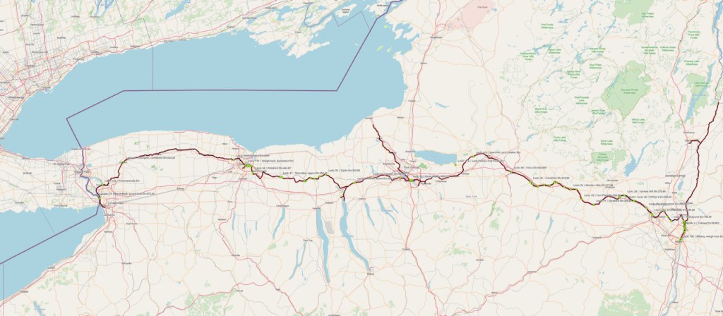
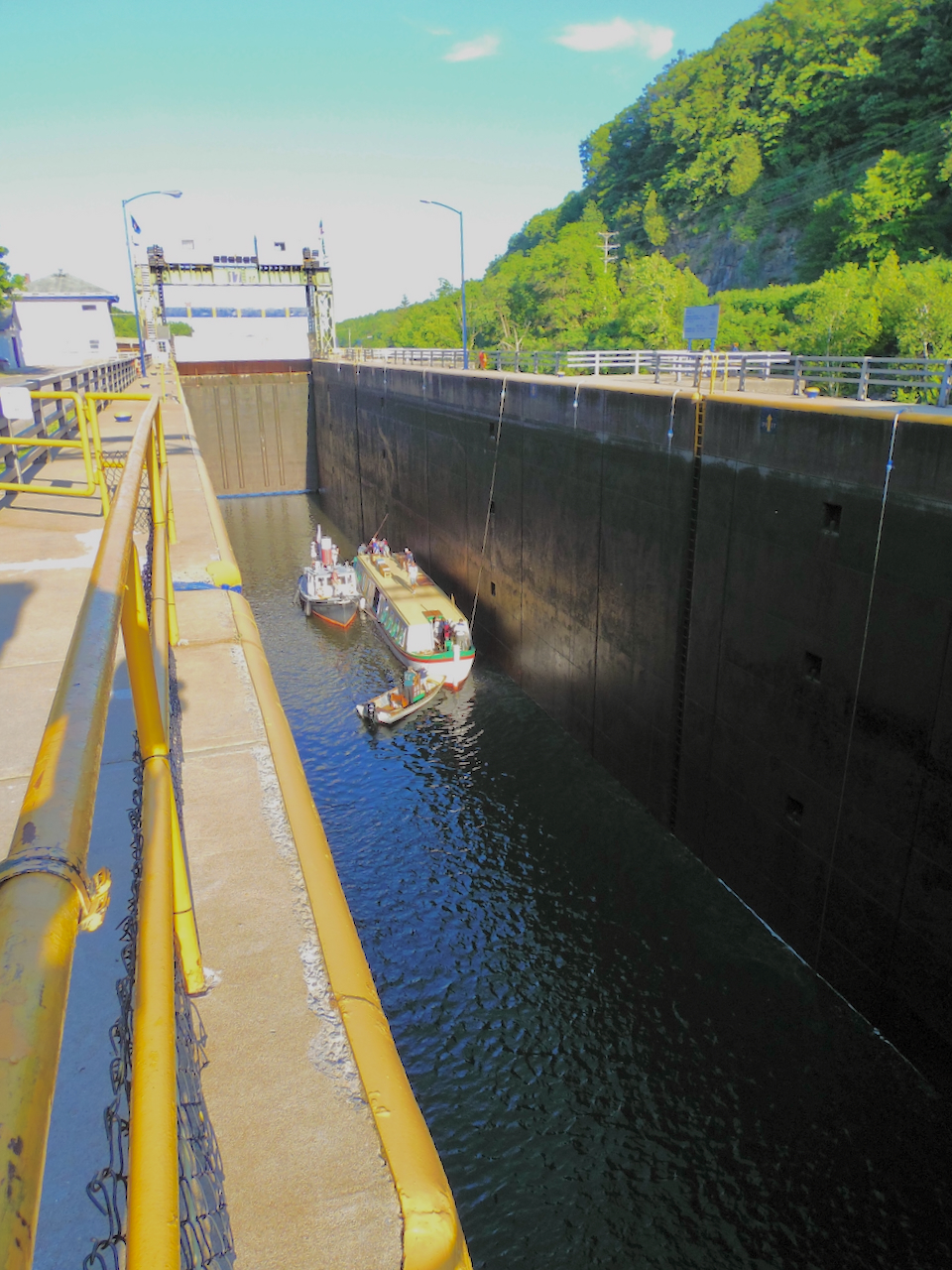
The image below shows the path of the 19th century Erie Canal, not the later Barge Canal path active since 1918. You’ll see this again on the interactive portion of this post.
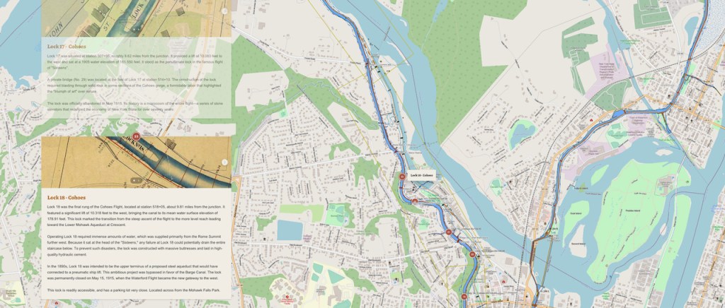
Let’s look at the 19th century canal locks in Albany County, the eastern end of the canal at that time. Double click on the image below to make it live, or interactive. Then you should be able to scroll through the lock and infrastructure viewer beginning with the cover and statewide New York map. As you scroll through, note the red dots indicating locks and other infrastructure. Then notice the information such as text, archival images, contemporary photos and more in the boxes to the left side of the screen. As you scroll through the boxes, the map area shown advances automatically.
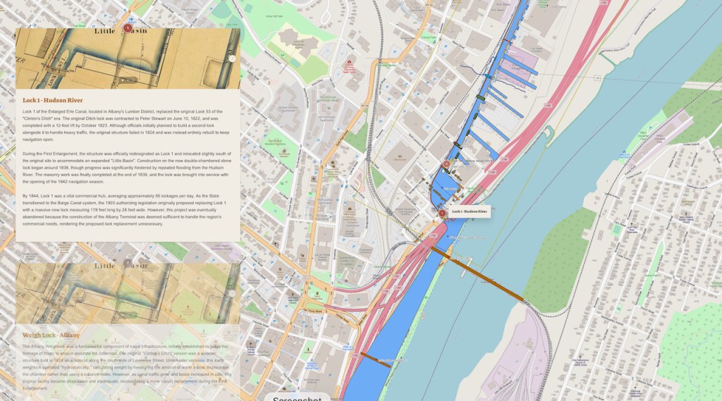
The image below in not interactive for this reason; I want to point out that the text in the boxes-in this case Lock 18 Cohoes-has been retrieved from CSNY documents going back to the beginning, 1964, and only recently digitized. The retrieval has been done using an artificial intelligence (AI) program called NotebookLM, a Google tool built on Gemini. I want to emphasize, AI has been instructed to retrieve this info from reliable CSNY documents.
Be sure to click on the drop-down “About the Historic Erie Canal Map,” as it lists all the sources and something about the process. The maps used to compile the digital map ranges from the 1830 to 1950. The important Blue Line and Schillner maps are late 1890s.
I have three reasons for sharing this short introduction to Steven’s work. At the upcoming Winter Symposium on March 7, 2026, you’ll learn more about the project. Reason #1: this provides amazing experiences and opportunities for canal cartophiles. Reason #2: it allows the images and other documents in the CSNY current collections to be integrated into a whole. Reason #3: this project allows CSNY members to engage with CSNY mission, i.e., protecting, researching, preserving, and educating the public about our state’s 200+ years of canal history and heritage.
Looking for a project? The roads are snowed in, the canal traces across the state invite exploration and discovery, and the opportunities to help develop this, unbounded.


Leave a comment