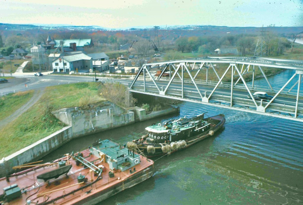
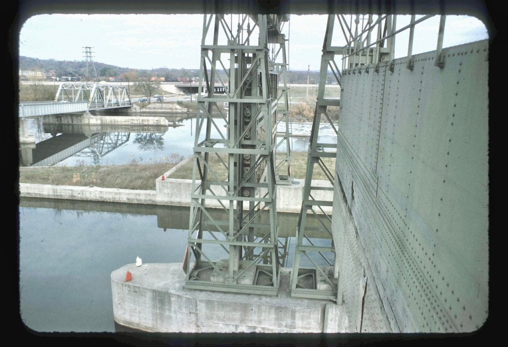
Following on Classics 1, here’s a set captured in the glory days of Kodakchrome as used by Albert Gayer. It looks like fall. Note the freight train in the distance. After studying these photos, I think I know the location, which I’ll share at the end of the post. Tell me if you agree or disagree.
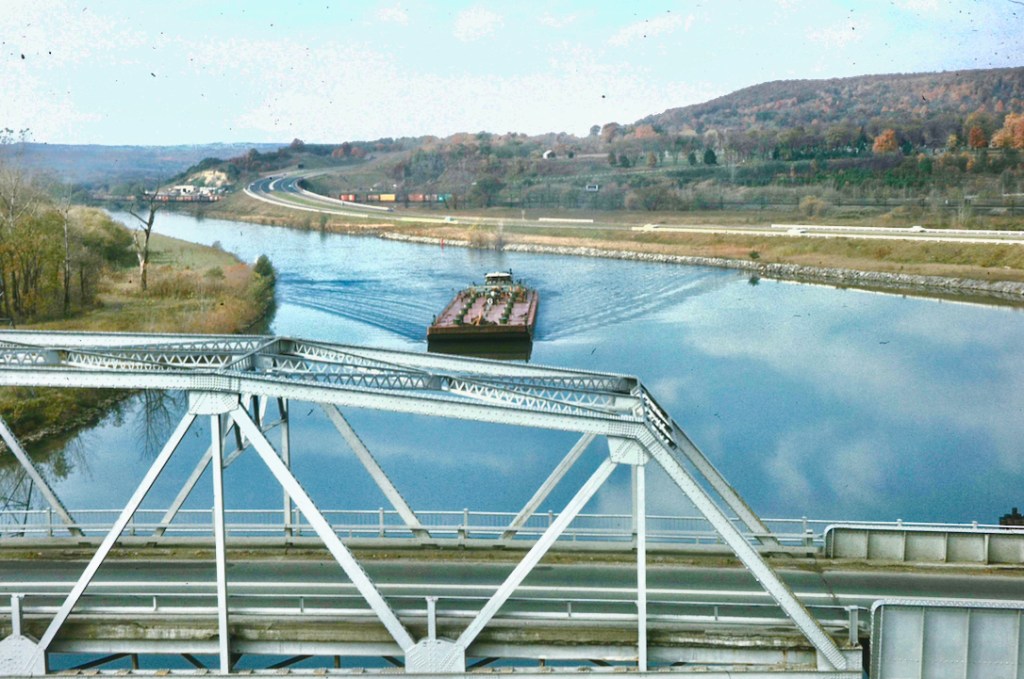
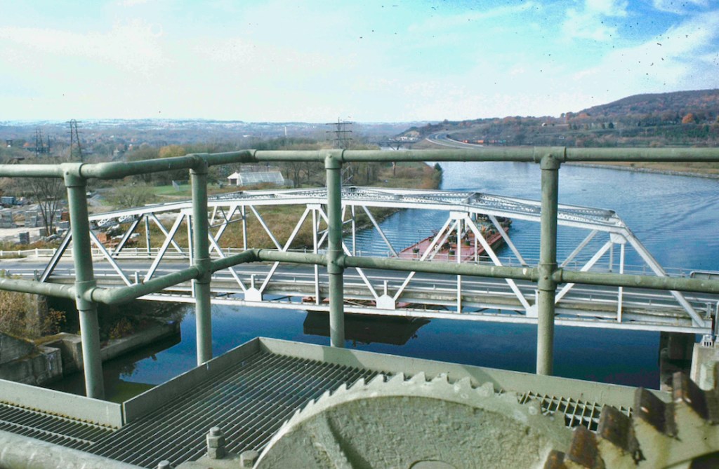
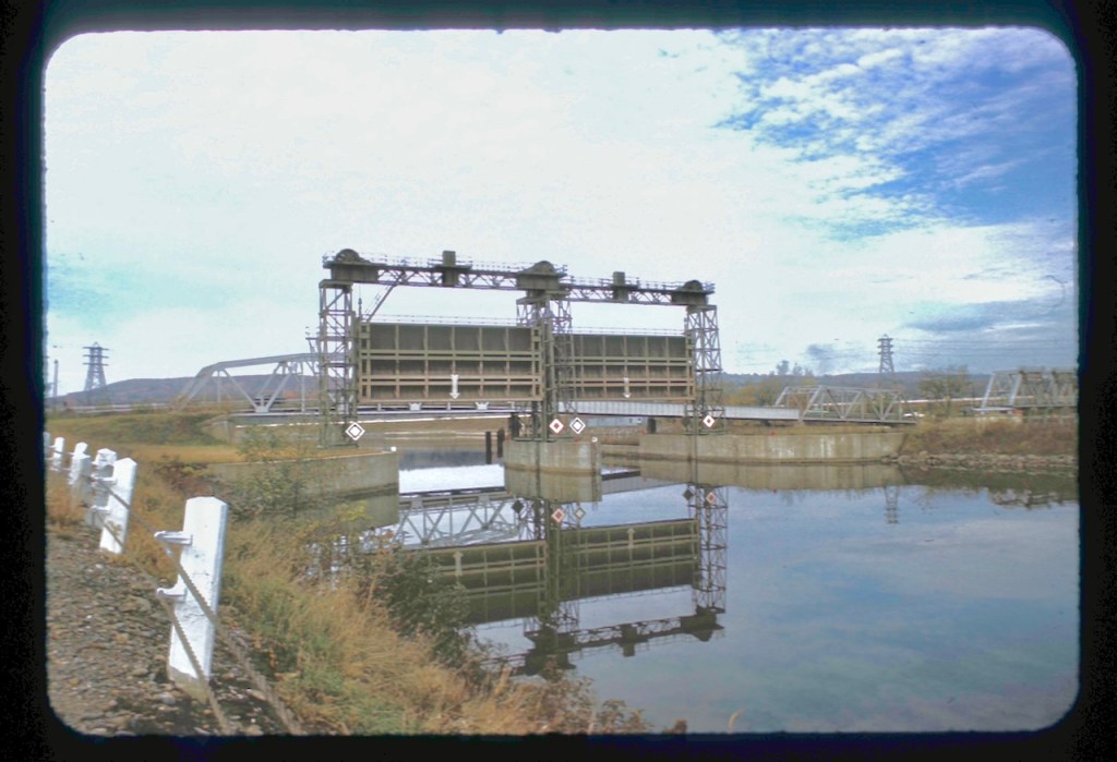
I’m quite sure Mr. Gayer had permission to shoot from this guard gate vantage point. If I climbed here and shot these today without an arrangement, I’d be arrested. Also, I believe this bridge is no longer intact; at least it’s no longer used for road traffic.
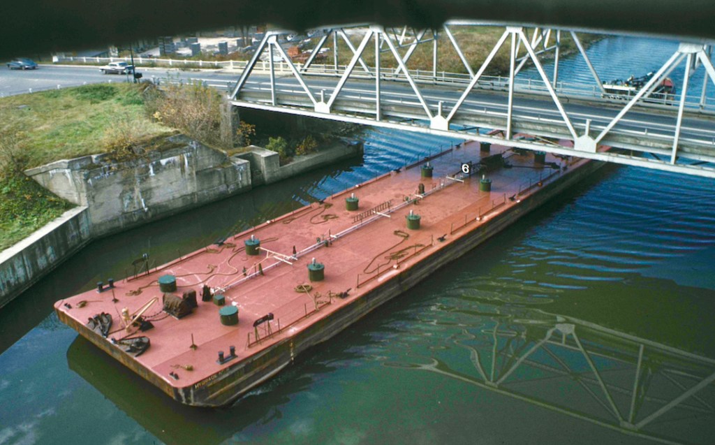
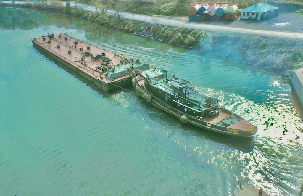
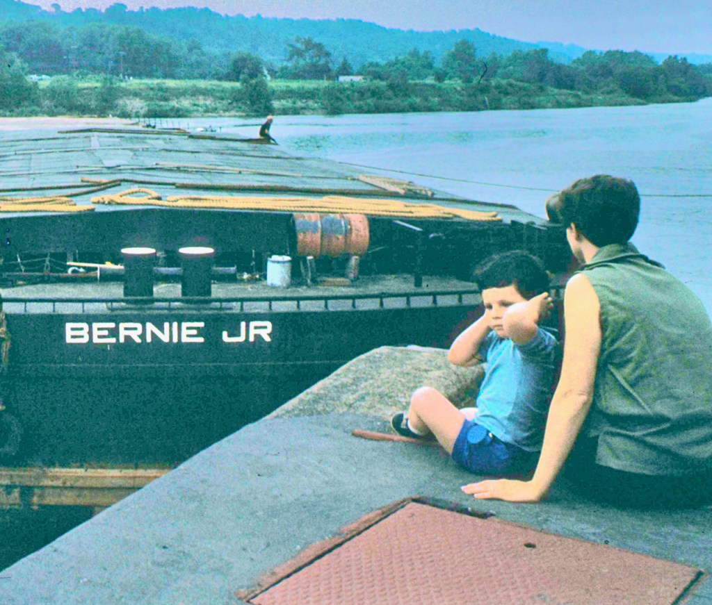
About a year ago, I posted images of this same tugboat and barge here. I believe these photos were taken shortly before those photos from March last year. That’s a clue to my idea of this location. In that post, I included identification of and more information about the tugboat.
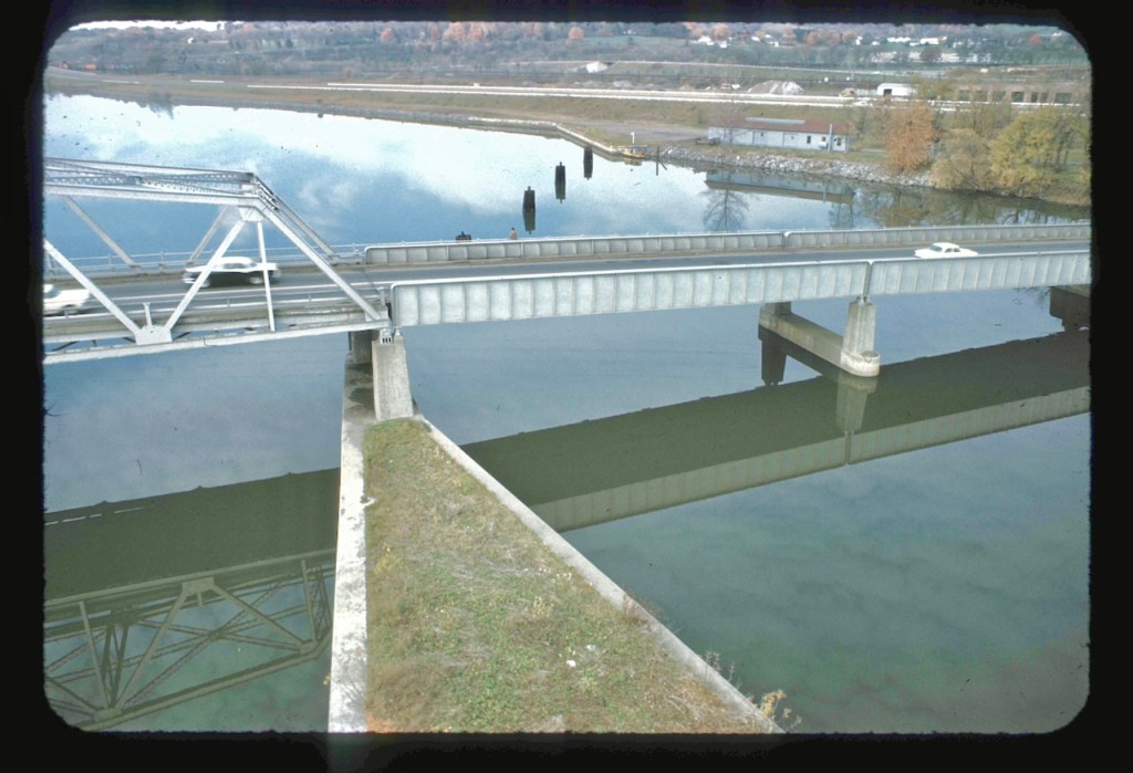
The road closest to the right bank is now bike path, I believe.
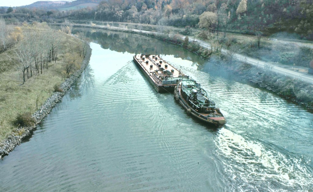
The remaining photos, I conclude, were taken before the ones at the top of this post.
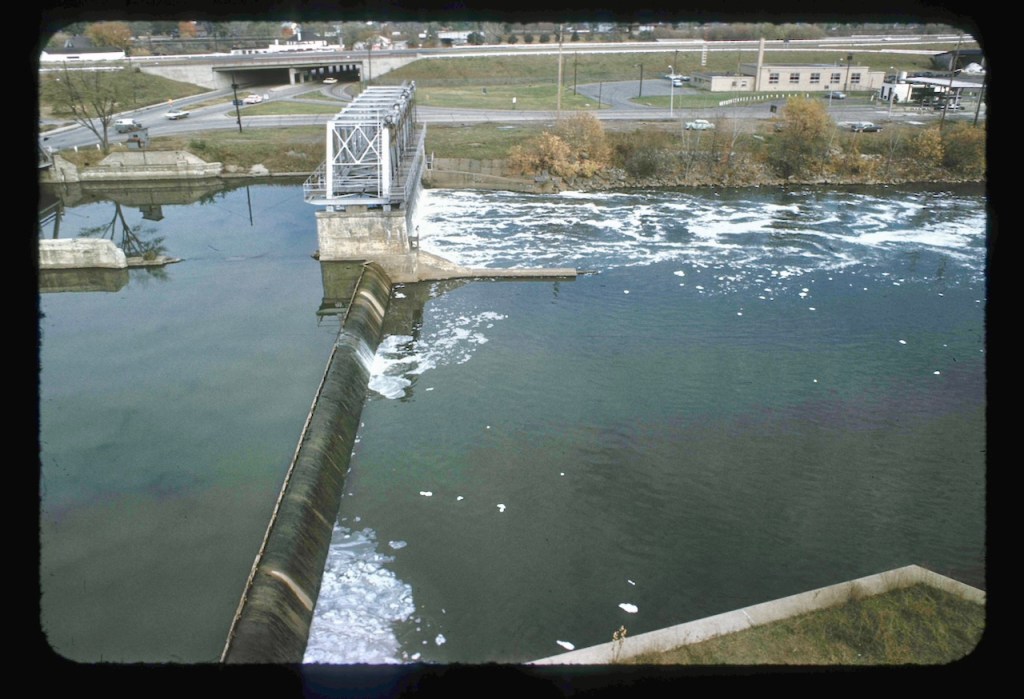
The gray building on the opposite bank has now been enlarged and is a busy summer spot.
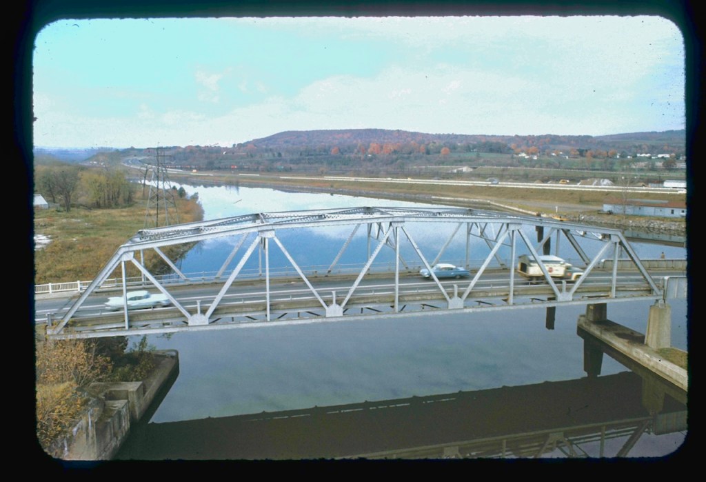
These are all classics: the photos, the canal, the cars, the times.
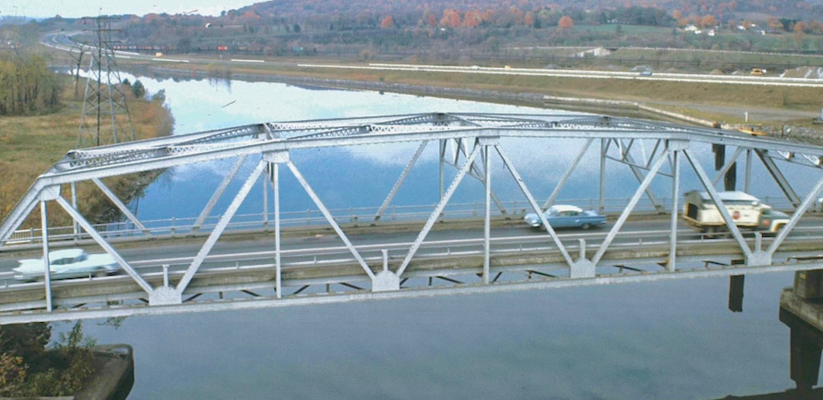
And my guess for the location is Guard Gate #5, Mohawk to the left and Herkimer to the right. Sagamore is pushing the tank barge east, heading for lock E-18.
Got photos and ideas of classic Canal shots? Get in touch.
Any errors? Please set the record straight.

Leave a reply to unabashedc3f8a5d033 Cancel reply