Click here for previous cartophile posts, focusing on maps in the CSNY collection. CSNY Samuel Center houses many maps, and the society is acquiring more maps all the time. This post is intended to whet the appetite of map-lovers, some of whom I hope will step forward to study these maps in detail and comment either in the space provided or even volunteer to write guests posts expanding on the maps here.
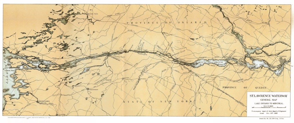
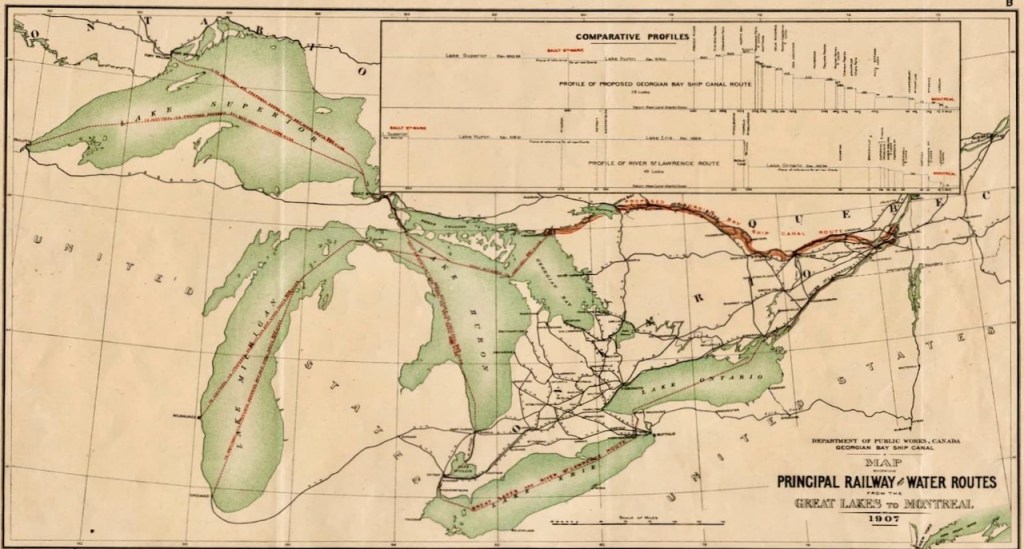
Since I’m currently traveling on the St Lawrence, specifically the St Lawrence Seaway canals, which opened in the 1950s, my first selection here dates from 1926. Given my goal here, I’m including the entire, depicting about 200 miles during which distance the river drops over 200 feet.
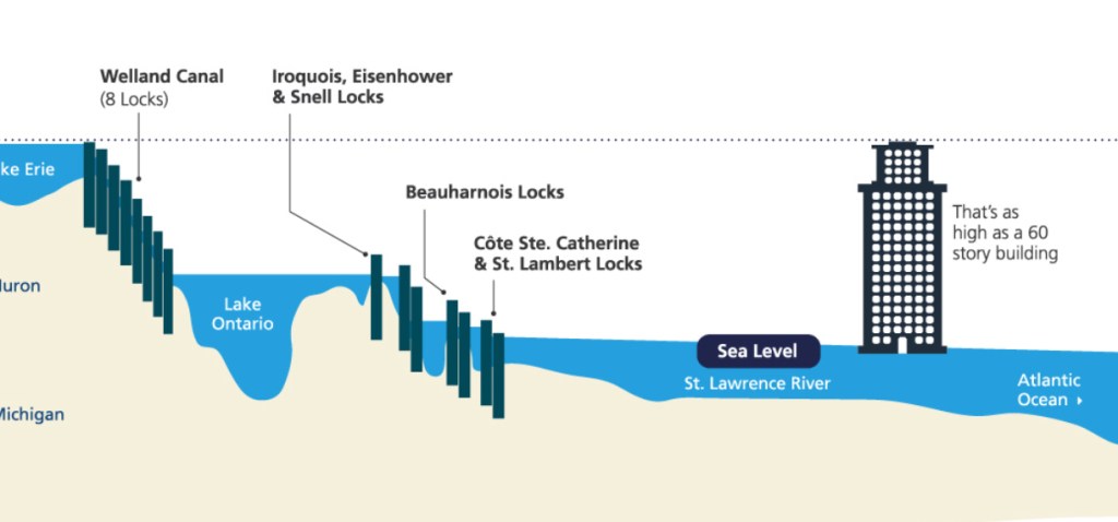
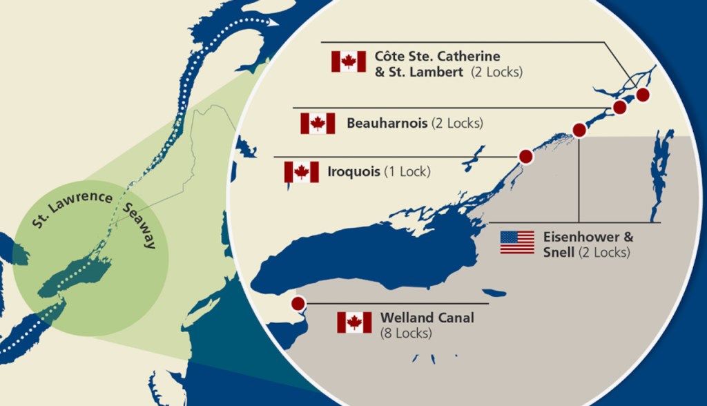
To illustrate how safe navigation happens on the St Lawrence today, check the two diagrams below.
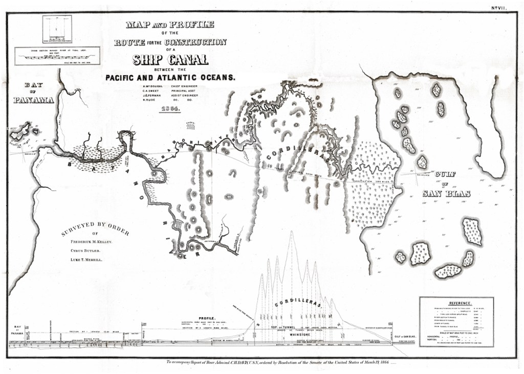
The second map shows a plan for a ship canal across the Panamanian isthmus dating from 1864.
More treats for cartophiles later. Many thanks to Bill Hecht for cleaning up these images.

Leave a comment