
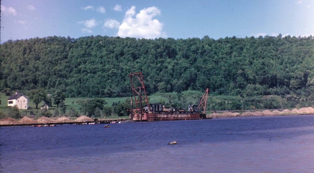
Here’s a follow-up to the dredge post of May 24. This clipping passed along by Craig Williams appeared in the September 12, 1940 Fort Plain Standard. It mentions a 1941 dredging contract awarded to Dunbar and Sullivan in the 17-mile stretch between Mindenville and Yosts.
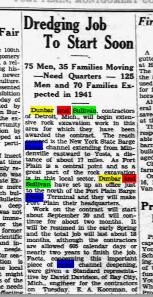
Given that two years was allotted for the job, I wonder if the dredge was towed into the corridor and then towed to the next job after this one’s completion. Are there other photos of this particular dredge or of others by Dunbar and Sullivan?
Many thanks to Craig for sending along this clipping. Does anyone know more to the story? Did any of these displaced folks decide to settle in the Fort Plain area?
Other dredge posts can be read here. Are there any readers out there who have other dredge stories and photos, either recently or longer ago?
Marginally related: Here’s a bird’s eye view of Fort Plain from the past.

Leave a comment